Web GIS Fellow, Office of Sustainability & Climate
A complete application consists of:
- An application
- A current resume/CV
- Transcripts – For this opportunity, an unofficial transcript or copy of the student academic records printed by the applicant or by academic advisors from internal institution systems may be submitted. Selected candidate may be required to provide proof of completion of the degree before the appointment can start.
All documents must be in English or include an official English translation. If you have questions, send an email to USForestService@orise.orau.gov . Please include the reference code for this opportunity in your email.
Specifically, the Fellow will:
• Participate with OSC staff members to develop new GIS web mapping content; and update and enhance existing web mapping content.
• Identify gaps in content or opportunities for modifying GIS application design to improve GIS tool delivery and utility to stakeholders and other customers.
• Assist OSC staff members with the management and maintenance of GIS datasets, including metadata
• Recommend ways to leverage external web-mapping applications and GIS data or social media channels to improve our connections with stakeholders, giving proper attention to plans and actions the Forest Service is taking to prepare for large-scale disturbance events.
• Coordinate activities for the OSC, Geospatial Technical Applications Center, and the Chief Information Office on web-map related issues and efforts.
• Support data and science delivery efforts by developing online web maps and story maps including configuring and deploying web map services.
• Assist OSC staff members with administering and configuring the Forest Service climate Open Data group to distribute data to the public through data.gov.
• Support OSC in various science delivery and communications tasks as assigned.
This position provides an opportunity to:
• Learn about natural resource conservation and policy issues at a national level while helping integrate information from diverse program areas.
• Gain first-hand knowledge of the Forest Service’s GIS data management, application deployment, and data distribution processes.
• Understand and contribute to the intersection of science and policy.
The Fellow also will have the opportunity to interact with scientists in Forest Service research stations and managers in the National Forest System. While this is primarily a headquarters-based fellowship, opportunities to support field efforts are possible. The fellow may explore options for future graduate research and take advantage of additional training opportunities.
Strong candidates for the position will have:
• Knowledge of geospatial technology (e.g., geographic information systems; image processing; remote sensing; web, mobile and global positioning systems)
• Experiencing creating and managing GIS web services, applications, and data.
• Experience with esri’s mapping platform including ArcGIS Server, ArcGIS Online (AGOL), and ArcGIS Desktop.
• A good sense of design, strong writing skills, and experience constructing AGOL story maps applications that users find pleasing to visit and intuitive to navigate
• Demonstrated strong written and verbal skills
• Ability to effectively synthesize information
• A collegial and collaborative working style
- Citizenship: U.S. Citizen Only
- Degree: Bachelor's Degree or Master's Degree.
-
Discipline(s):
- Business (1 )
- Communications and Graphics Design (2 )
- Computer, Information, and Data Sciences (3 )
- Earth and Geosciences (1 )
- Engineering (2 )
- Environmental and Marine Sciences (8 )
- Life Health and Medical Sciences (6 )
- Mathematics and Statistics (10 )
- Other Non-Science & Engineering (1 )
- Social and Behavioral Sciences (1 )

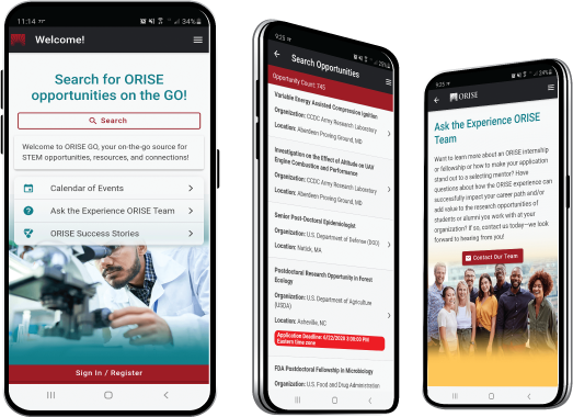
 ORISE GO

The ORISE GO mobile app helps you stay engaged, connected and informed during your ORISE experience – from application, to offer, through your appointment and even as an ORISE alum!


