Characterizing Low-Order Aquatic Systems and Flow Variability at the Watershed Scale
A complete application consists of:
- An application
- Transcript(s) – For this opportunity, an unofficial transcript or copy of the student academic records printed by the applicant or by academic advisors from internal institution systems may be submitted. All transcripts must be in English or include an official English translation. Click here for detailed information about acceptable transcripts.
- A current resume/CV, including academic history, employment history, relevant experiences, and publication list
- Two educational or professional recommendations
All documents must be in English or include an official English translation.
If you have questions, send an email to EPArpp@orau.org. Please include the reference code for this opportunity in your email.
*Applications will be reviewed on a rolling-basis.
A research opportunity is available at the Environmental Protection Agency (EPA), Office of Research and Development (ORD), National Exposure Research Laboratory (NERL), Systems Exposure Division (SED) located in Cincinnati, Ohio.
The goal of this research opportunity to improve the characterization and mapping of aquatic systems and quantify their spatial and temporal variability across the landscape.
Aquatic resources such as streams and riparian wetlands play an integral part in maintaining clean and plentiful water for aquatic ecosystems and human beneficial uses. Yet, the spatial extent and flow-characteristics of such systems are difficult to map accurately given their spatial and temporal variability and the limitations of past remote sensing and other geospatial approaches. Recent advancements in remote sensors, modeling techniques, data processing capacities and statistical approaches may allow for bridging past technological barriers to improve aquatic resource mapping. The improved mapping of aquatic systems and variability assessment assists both underlying scientific understanding of hydrology as well as informing aquatic resource management at local, state, and regional scales.
The research participant will collaborate with ORD scientists to combine fine-scale remotely sensed data with additional geospatial data, GIS analysis, and novel statistical approaches to improve the mapping of aquatic resources. A primary goal is improved lateral and longitudinal mapping of low-order stream systems and associated riparian wetlands. The research participant may also collaborate with ORD scientists and other postdoctoral researchers to determine advanced characterizations of flow permanence of river network components. The research project will concentrate on selected watersheds within the conterminous United States where field validation data are available.
The research participant will join a productive and driven research team of watershed hydrologists and systems ecologists. The research may lead to multiple publications of the study findings in scientific journals and present at professional conferences. The research participant will gain valuable experience in the applied fields of remote sensing, geospatial techniques and statistical approaches within aquatic systems, be engaged with a collaborative group, and produce scientific publications that will further our scientific knowledge in the area of aquatic resources.
The mentors for this opportunity are Dr. Jay Christensen (Christensen.jay@epa.gov), Dr. Charles Lane (lane.charles@epa.gov) and Dr. Heather Golden (golden.heather@epa.gov).
Anticipated Appointment Start Date: October 1, 2019
This program, administered by ORAU through its contract with the U.S. Department of Energy (DOE) to manage the Oak Ridge Institute for Science and Education (ORISE), was established through an interagency agreement between DOE and EPA. The initial appointment is for one year, but may be renewed upon recommendation of EPA and is contingent on the availability of funds. The participant will receive a monthly stipend commensurate with educational level and experience. Proof of health insurance is required for participation in this program. The appointment is full-time at EPA in the Cincinnati, Ohio, area. Participants do not become employees of EPA, DOE or the program administrator, and there are no employment-related benefits.
The qualified candidate should have received a doctoral degree in one of the relevant fields, or be currently pursuing the degree and will reach completion by the start date of the appointment. Degree must have been received within five years of the appointment start date.
Preferred skills:
- Experience and knowledge in remote sensing techniques, existing geodatabases relating to hydrology and watershed hydrology applicable for watershed, landscape-scale, and/or surface water analyses
- Demonstrated skill in GIS and remote-sensing software and applications
- Experience with advanced statistical methods for watershed, landscape-scale, and/or surface water analyses
- Proficiency with scripting (e.g., Python, R, SAS) languages
- Degree: Doctoral Degree received within the last 60 months or anticipated to be received by 10/1/2019 11:59:00 PM.
- Discipline(s):

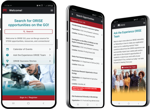
 ORISE GO

The ORISE GO mobile app helps you stay engaged, connected and informed during your ORISE experience – from application, to offer, through your appointment and even as an ORISE alum!


