Research Opportunity in Soil Science
A complete application package consists of:
- An application
- Transcript(s) – For this opportunity, an unofficial transcript or copy of the student academic records printed by the applicant or by academic advisors from internal institution systems may be submitted. Selected candidate must provide proof of completion of the degree before the appointment can start. Proof must be sent to ORISE directly from the academic institution including graduation date and degree awarded. All transcripts must be in English or include an official English translation. Click Here for detailed information about acceptable transcripts.
- A current resume/CV
- Two references – While two references are requested, applications will be considered without reference information. It is preferred that a complete application package contains a minimum of one reference.
If you have questions, send an email to USDA-ARS@orau.org. Please include the reference code for this opportunity in your email.
A research opportunity in soil science is available with the U.S. Department of Agriculture (USDA) Agricultural Research Service (ARS) Dale Bumpers Small Farms Research Center (DBSFRC) in Booneville, AR.
As a member of a multi-disciplinary team, the candidate will collaborate with the Water-Smart Agriculture Program for Mesoamerica which seeks to revitalize smallholder rainfed agriculture in Mesoamerica by advocating for water-smart agricultural policies, investments and programs. The overarching vision of the program is to positively transform the food and water security of a critical mass of farmers in the region by increasing agricultural productivity, improving the management of soil and water resources, and strengthening farmers’ economic and environmental resilience.
The project involves:
-
Learning how to utilize ArcGIS software, ArcSIE software, terrain analysis software and statistical software. Additionally, this opportunity will provide methods to incorporate soil data to create continuous functional knowledge-based inference digital soil property maps;
-
The educational opportunity will demonstrate how to utilize mapping processes based on the best available digital elevation model (DEM) (at least a 30-meter digital elevation model) that depicts landscape-soil-hydrology relationships to develop quantitative predictable patterns reflected by soil morphology and soil classification differences and;
-
Learning how the resulting property maps shall be validated in combination with the country teams and local experts. A measurement of prediction quality shall be attached to each property map and in case of required data improvement, a sampling strategy based on the Latin Hypercube Sampling methodology;
The overall goal of the maps is to couple pedological, hydrological and biogeochemical processes to integrate and define processes that affect agriculture and environmental applications of soils, which ultimately lead to better utilization of the soils as a natural resource. Activities include learning about national scale program management which includes assisting country coordination and project plan development, evaluating map products for accuracy and coordinating training for country cooperators
The appointment is full-time for 12 months and may be renewed based upon recommendation of the ARS and availability of funding. The selected applicant will receive a stipend as support for their living and other expenses during this appointment. Stipend rates are determined by ARS officials, and are based on the applicant’s academic and professional background. The participant must show proof of health and medical insurance. Health insurance can be obtained through ORISE. The participant will not enter into an employee/employer relationship with ORISE, ORAU, USDA, ARS, or any other office or agency. Instead, the participant will be affiliated with ORISE for the administration of the appointment through the ORISE appointment letter and Terms of Appointment.
While participants will not enter into an employment relationship with ARS, this position requires a pre-appointment check and a full background investigation.
This opportunity is available to U.S. citizens, Lawful Permanent Residents (LPR), and foreign nationals. Non-U.S. citizen applicants should refer to the Guidelines for Non-U.S. Citizens Details page of the program website for information about the valid immigration statuses that are acceptable for program participation.
For more information about the ARS Research Participation Program, please visit the Program Website.
-
Qualifications include a minimum of a M.S. degree in Soil Science or a closely related field and Ph.D. level coursework.
-
The participant should have some experience in both applied and basic understanding of soil science principles and techniques.
-
The research assignment requires knowledge of digital soil mapping, pedology and landscape analysis techniques.
-
Proficiencies in geographic information systems, computer skills, data collection, and statistical analyses.
-
It is highly desired that the successful candidate have strong communication skills and be fluent in Spanish.
-
Additionally, the candidate must be able to willing to participate in training on methods to initiate research projects and how to participate effectively in multi-institutional and multi-national projects.
Broad knowledge of approaches in digital soil mapping and pedologic principles for predicting soil properties and soil functional units in areas with limited data. The incumbent should have an understanding of geographic information systems and other softwares for developing digital soil maps. Experience with digital soil mapping tools, terrain attributes and soil map development are favorable for this opportunity. It is preferred that the successful candidate will have knowledge of sophisticated, basic and applied pedology to incorporate into soil maps and interpretations.
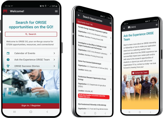
The ORISE GO mobile app helps you stay engaged, connected and informed during your ORISE experience – from application, to offer, through your appointment and even as an ORISE alum!